Cost Guide
Cost of geophysical survey in Nigeria 2026
Geophysical survey maps what is underground before you dig. This guide explains what surface and borehole geophysical surveys cost in Nigeria, what each method finds, and what a proper quote should include.

Average Cost of Geophysical Survey, Labour + Materials
Estimated cost of Geophysical Survey, including labour and materials.
This price type is not available in the local price file for this location yet.
Average Cost of Geophysical Survey, Labour Only
Estimated labour cost of Geophysical Survey, excluding materials.
This price type is not available in the local price file for this location yet.
Nigeria-wide figures use the local General / Nigeria record, or typical values from available state records. Final quotations depend on scope, specification and site condition.
Open full calculator1. Cost of geophysical survey in Nigeria 2026
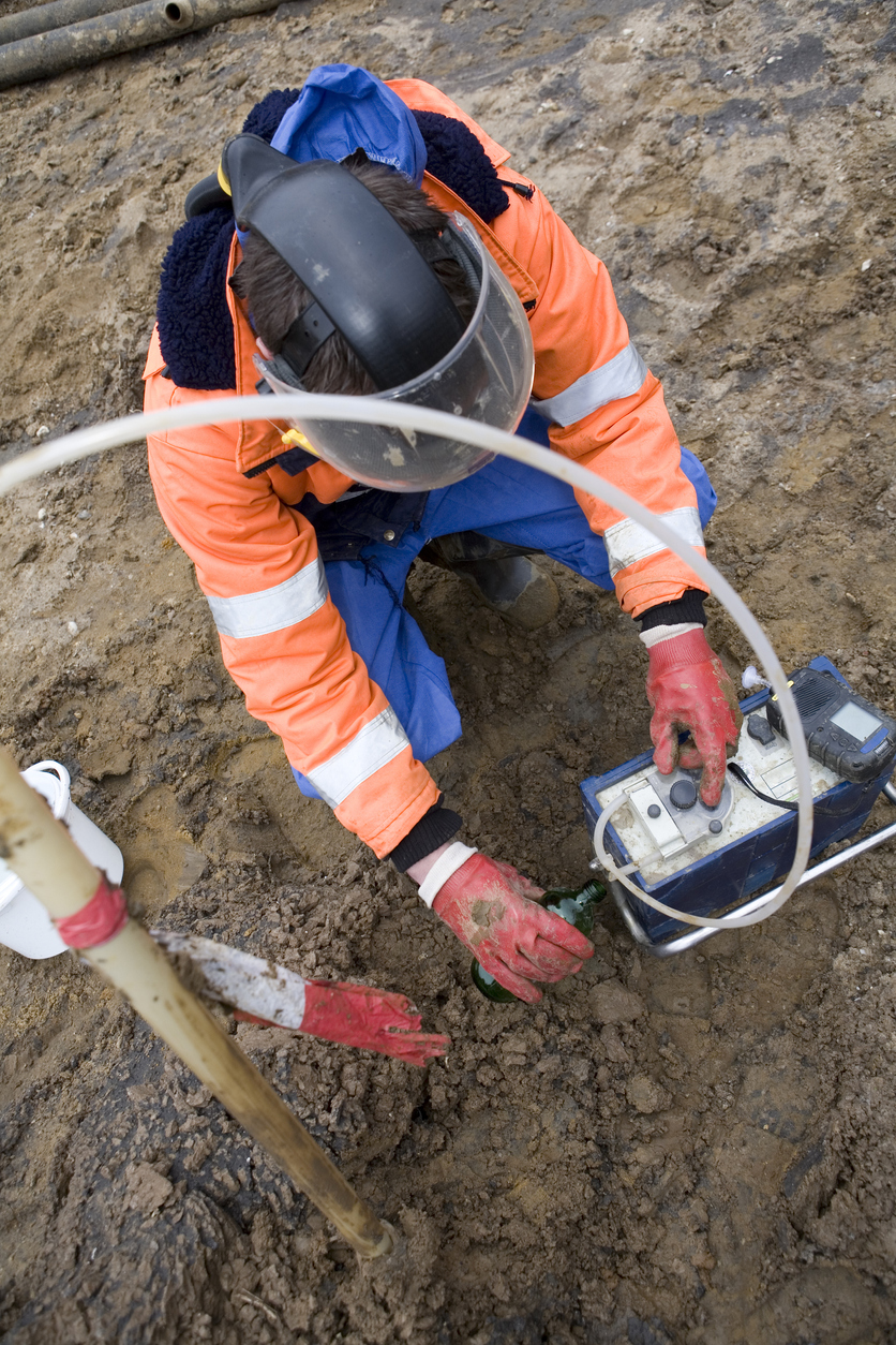
A geophysical survey is the pre-construction step that maps what is underground without digging. It uses measurements taken at the surface — or down an existing borehole — to detect changes in the ground: the depth to rock, the presence of water, soft pockets, cavities, buried services, or the boundary between soil layers. In Nigerian practice, geophysical surveys are used for foundation design, borehole siting for water, groundwater studies, and checking for voids or anomalies on larger sites.
The critical point about geophysics is that it indicates rather than confirms. It tells you where to look and what to expect; it does not replace a borehole. The most reliable investigations combine geophysics with at least one borehole or trial pit to calibrate the results.
This guide explains what geophysical surveys cost, what the different methods are for, and what to check in a quote so you get data you can actually use.
2. How geophysical surveys are measured
Surface geophysical methods are measured by survey line — a line of measurements across the site, usually 50–200 m long — and the number of lines depends on the site size and the target. Borehole geophysics is measured per borehole, since the tools are lowered into an existing hole. Some contractors quote per day instead, especially on small jobs. Always confirm whether the price is per line, per borehole, or per day, and whether interpretation and reporting are included, because the survey data without interpretation is of limited use.
3. Quick answer - geophysical survey prices in Nigeria 2026
| Pricing basis | Low | Average | High |
|---|---|---|---|
| Surface survey, labour and materials per line | ₦20,000 | ₦25,000 | ₦40,000 |
| Borehole geophysics, per borehole | ₦35,000 | ₦50,000 | ₦100,000 |
Total = (survey lines × per-line rate) + (boreholes × per-borehole rate) + mobilisation + interpretation and report.
4. What low, average and high mean
Low is a small residential plot with a few short resistivity lines and a basic interpretation, usually to check depth to rock or locate a water-bearing zone.
Average is a larger plot or small estate with several lines, a mix of methods, and a proper interpreted report with a recommended borehole position.
High is a large site, multiple methods (resistivity plus seismic), borehole geophysics in several holes, and a full engineering report, or work in difficult terrain or remote locations.
5. Factors that change the price of geophysical survey
- Site size and number of lines - more lines mean more field time and more data to process.
- Method used - electrical resistivity is common and relatively cheap; seismic refraction and borehole geophysics cost more because of equipment and expertise.
- Target depth - deeper targets need longer lines and different equipment settings.
- Terrain and access - bush, swamp, or steep ground slows the survey and adds cost.
- Number of boreholes for borehole geophysics - each hole adds cost.
- Interpretation and reporting - a proper report with recommendations is part of the value, not an optional extra.
- Mobilisation distance - remote sites add travel and equipment movement costs.
6. Cost breakdown - what you are paying for
- Mobilisation and equipment (15–25%) - moving the crew and instruments to site.
- Field measurements (35–45%) - the survey lines or borehole logging.
- Data processing (10–15%) - cleaning and modelling the readings.
- Interpretation and report (15–20%) - turning data into a recommendation.
- Supervision and quality checks (5–8%) - ensuring the data is reliable.
7. What a geophysical survey quote should include
- Methods proposed and why
- Number and length of survey lines
- Number of boreholes for borehole geophysics
- Target depth and what the survey is looking for
- Field measurements and data processing
- Interpretation and a written report with recommendations
- Mobilisation and access requirements
- Turnaround time
8. What can go wrong with geophysical surveys
- No calibration - geophysics without at least one borehole to calibrate the results can be misleading; the readings are interpretations, not certainties.
- Wrong method for the target - resistivity is good for water and layer boundaries; seismic is better for depth to rock. Using the wrong method gives poor results.
- Too few lines - one line across a large site may miss anomalies between lines.
- No interpretation - raw data without a report is hard to use for design.
- Over-reliance on geophysics alone - it indicates; it does not confirm. A borehole is still needed for design.
9. Red flags to watch for
- A price with no method or line count stated - you cannot tell what you are buying.
- No interpretation or report - the data alone is not the deliverable.
- No calibration plan - geophysics without a borehole check is less reliable.
- Pressure to use geophysics instead of a borehole - it complements, not replaces, drilling.
- No stated target - a survey with no clear question will not answer one.
10. Questions to ask a geophysical survey contractor
- Which method are you proposing, and why is it right for what I need to find?
- How many lines, and how long will they be?
- Will the results be calibrated against a borehole?
- Is interpretation and a written report included?
- What is the turnaround time, and what access do you need?
11. How to compare two geophysical survey quotes
Compare on method, number and length of lines, calibration plan, interpretation and report, and target depth. A cheaper quote for fewer lines with no interpretation is not a saving; it is data you cannot use. Ask both contractors to state the method and the deliverable in writing. If the survey is part of a foundation investigation, compare before you build so the geophysics, the boreholes, and the foundation design are planned together rather than as separate exercises.
12. Geophysical survey compared with other investigations
| Investigation | Cost basis | Best for | Trade-off |
|---|---|---|---|
| Surface geophysical survey | Per survey line | Mapping strata, water, anomalies over a site | Indicates only, needs borehole confirmation |
| Borehole geophysics | Per borehole | Detailed logging of an existing hole | Needs a borehole first |
| Soil testing and investigation | Per borehole plus tests | Foundation design | Slower, more costly, but confirms strength |
| Trial pits | Per pit | Quick shallow look | Limited depth |
13. Common mistakes
- Using geophysics as a substitute for a borehole - it indicates, it does not confirm.
- Choosing the wrong method - resistivity, seismic, and borehole logging answer different questions.
- Skipping the interpretation - data without a report is not usable for design.
- Too few lines - anomalies between lines are missed.
Planning example
A 50 m × 40 m plot with a proposed two-storey building needs to check depth to rock and locate a water-bearing zone. That typically means four to six resistivity lines across the plot, one calibration borehole, and an interpreted report recommending a borehole position and foundation depth. Multiply the lines by your per-line rate, add the borehole geophysics and the calibration borehole, add mobilisation and the report, and you have the survey budget. Use the materials estimator later when pricing the foundation, once the survey and borehole results are in.
14. FAQs
How much does a geophysical survey cost in Nigeria?
It depends on the method, the number of lines, and whether borehole geophysics and interpretation are included. This guide gives per-line and per-borehole rates to build a budget.
What is the difference between a geophysical survey and soil testing?
Geophysics maps the ground from the surface or from an existing hole; soil testing drills and tests samples to confirm strength. They complement each other.
What is a borehole geophysical survey?
Measurements taken by lowering tools down an existing borehole to log the layers, water, and ground properties in detail.
Can geophysics find water for a borehole?
Yes. Resistivity methods are commonly used to locate water-bearing zones before siting a borehole, though the borehole still confirms the water.
Do I still need a borehole if I do geophysics?
Yes. Geophysics indicates; the borehole confirms. Foundation design needs confirmed strength data.
How long does a geophysical survey take?
A small residential plot typically takes 1–3 days in the field plus a few days for processing and reporting.
Related Skillland services and guides
Ready to book a geophysical survey? Post your project with your site size and what you need to find, and compare contractors who include interpretation and a written report.
Geophysical Survey costs by state and the FCT
Choose a state or the FCT to view the local geophysical survey page, pricing and project guidance.
South West
North Central
South South
South East
North West
North East
Ready to start your project?
Post your project on Skillland and connect with trusted artisans and contractors in Nigeria.
Post a Project